Author: tarnado.bsky.social (did:plc:2etgbwm2s6glwadvacxclucn)
Record🤔
cid:
"bafyreibufxqgvoecsny6hrcf6lvnbhz4vbeyjdjckqm36zmsjxhgo3jika"
value:
text:
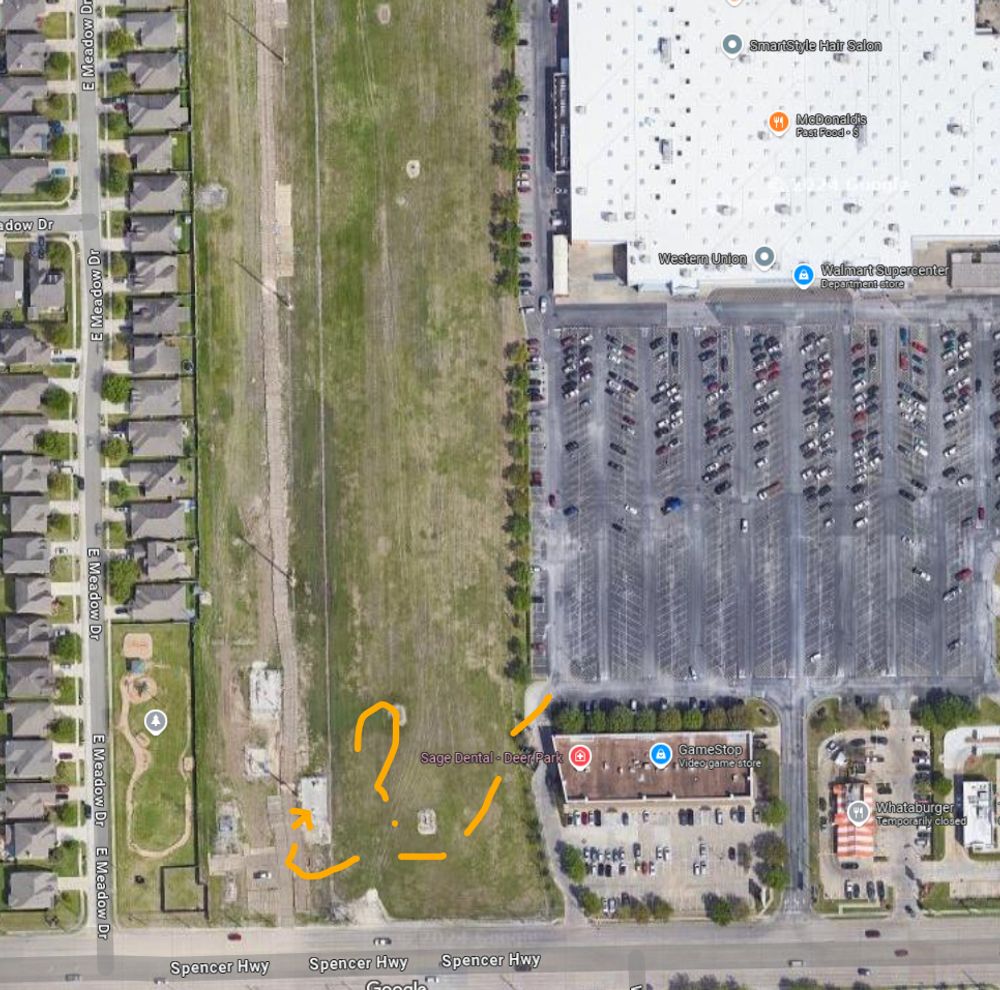
"The Deer Park police posted "preliminary reports suggesting no terroristic activity" on Twitter.

Evidently the person drove through the fence at the Wal-mart to the east; then south along the grassy pipeline right-of-way, then hooked north and back east??? instead of going to the road?"
$type:
"app.bsky.feed.post"
embed:
$type:
"app.bsky.embed.recordWithMedia"
media:
$type:
"app.bsky.embed.images"
images:
alt:
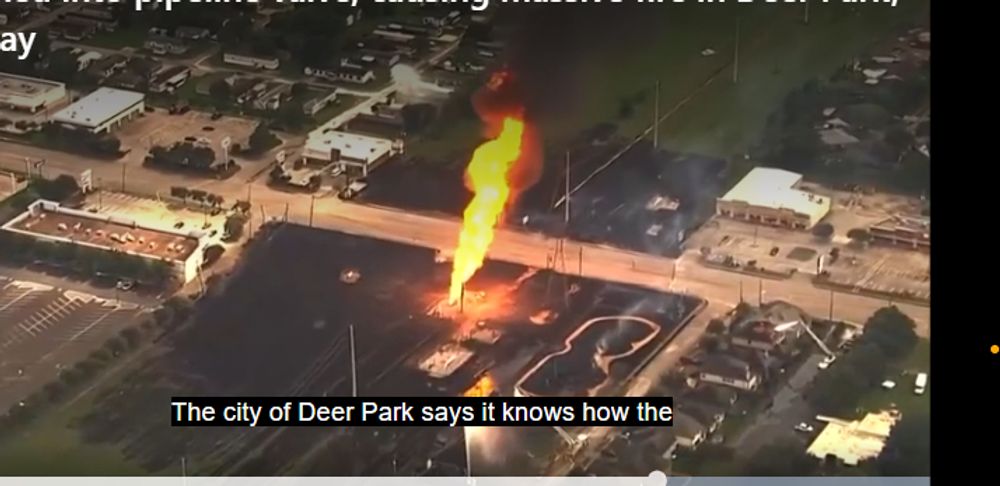
"A screenshot of a video showing the site of the pipeline fire in Deer Park, Texas; a column of fire extends into the air, surrounded by a larger area of blackened life. Structures have been melted. Source: https://www.msn.com/en-us/news/us/what-caused-the-pipeline-fire-in-deer-park-texas/ar-AA1qG8Lb?ocid=BingNewsVerp"
image:
View blob content
$type:
"blob"
ref:
$link:
"bafkreiadqrhiehuxlzutjqtbcwqhyi6ja5q2bqwogtujmop5tbw2e6ezlm"
mimeType:
"image/jpeg"
size:
241483
aspectRatio:
width:
714
height:
347
alt:
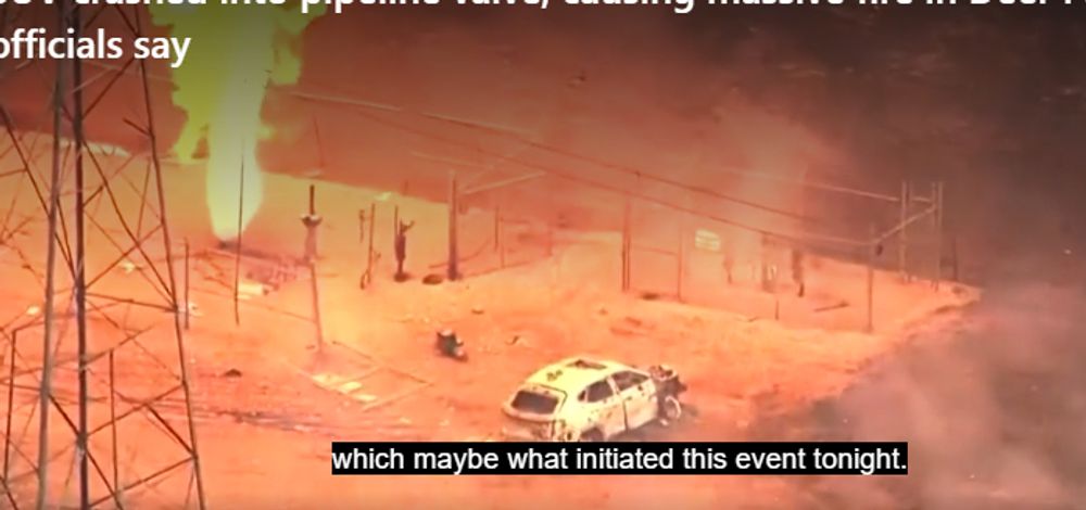
"A close-up from the news video, showing the location of the blaze. A thick column of flame extends upwards from the ground at the site of the pipeline valve; the fence (on the southern side of the enclosure) is broken by the SUV driver. The SUV is about 12 meters away from the blaze. Source: https://www.msn.com/en-us/news/us/what-caused-the-pipeline-fire-in-deer-park-texas/ar-AA1qG8Lb?ocid=BingNewsVerp"
image:
View blob content
$type:
"blob"
ref:
$link:
"bafkreigloxepentg6vf7ngcxifcs6vcogtlw2k3y7w3xh56pgiu5oloyi4"
mimeType:
"image/jpeg"
size:
220920
aspectRatio:
width:
698
height:
328
alt:
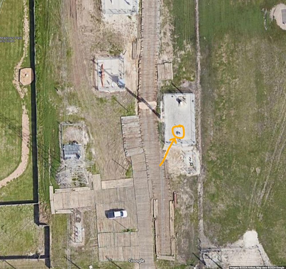
"Aerial image from Google Maps of the location of the destroyed natural gas valve; north is towards the top of the image. The vehicle was driven through the south-eastern quadrant of fencing (as shown elsewhere in the news video, the rest of the fence seems intact)."
image:
View blob content
$type:
"blob"
ref:
$link:
"bafkreifdefo2roiklklrj2ya3a7uxx7akhlz4z7nwwbztn3tfc2axaxyde"
mimeType:
"image/jpeg"
size:
869297
aspectRatio:
width:
1047
height:
982
alt:
"Another, zoomed out aerial image from Google Maps, showing the Wal-mart parking lot, the grassy pipeline and powerline right-of-way, and the pipeline valves/infrastructure. A dashed yellow line shows a potential route for the driver to have taken - supremely odd, as the actual road is just a stone's throw further south."
image:
View blob content
$type:
"blob"
ref:
$link:
"bafkreieghtej7xuur6ufsfuqc4zjyt47ybbysohgwhovtvzyrsoha2bzlu"
mimeType:
"image/jpeg"
size:
881499
aspectRatio:
width:
966
height:
956
record:
$type:
"app.bsky.embed.record"
record:
cid:
"bafyreidzroqpdhoywz2vlr2ldjo4dn3osg7mnlb6gpjmwtzwqaxgm34eye"
langs:
"en"
createdAt:
"2024-09-17T20:56:02.245Z"